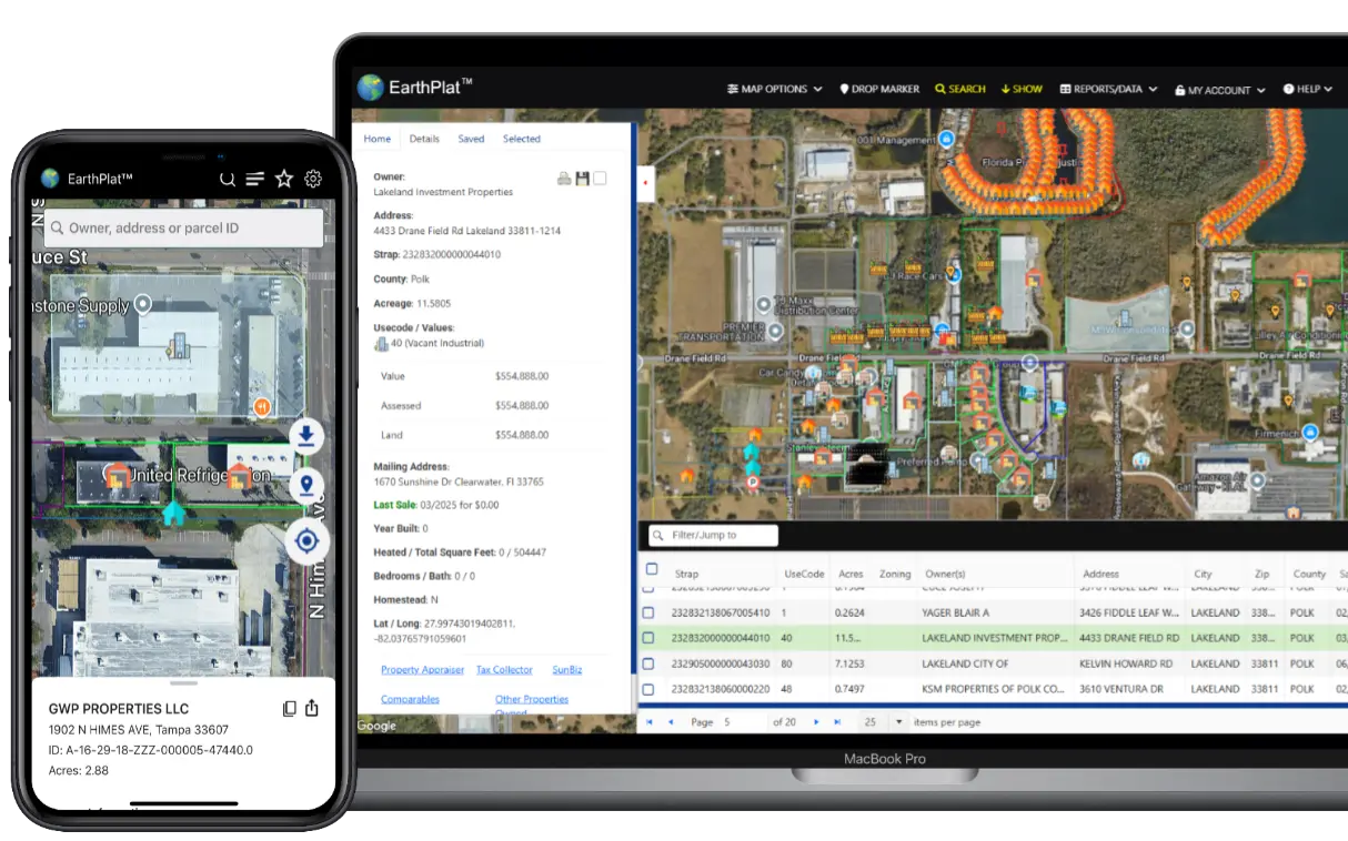
EarthPlat™ Cadastral Maps & Parcel Data
The Florida parcel detail search tool allows users to access specific information about land parcels in Florida.
This tool provides valuable data on property boundaries, ownership details, tax and sales information.
It is a useful resource for individuals, realtors, land surveyors and more
looking to research real estate properties or understand the ownership history of a particular parcel in Florida.
See how our Florida parcel data differs from others.
Try EarthPlat™ free for seven days.
Free 7-Day Trial

Features
Flexible Search
Searching for Florida parcels using our search you can input specific criteria such as size, sales, and ownership data to quickly identify parcels that meet your requirements.
Google Maps
Google Maps API technology offers numerous benefits to users. By integrating this technology into various applications, users can access accurate and up-to-date location information.
Results Grid
Grid search results provide a visually appealing and organized way to display information. Users can quickly scan through the results, making it easier to find what they are looking for.
Export Data
Exporting parcel results can be beneficial for data analysis. By exporting the results, researchers can further analyze the data using different statistical methods or visualization tools.
(Available on our Desktop version)
Save Parcels
Saving parcel results allows users to easily access important information later, providing a visual reference that can help users navigate back to a saved location. (Save up to 5 photos per saved location on mobile)
Access Anywhere
Accessing parcel data from mobile or online platforms offers unparalleled convenience. Whether you're on the go or relaxing at home, having this information at your fingertips can streamline decision-making processes.
Parcel Data Pricing
- Monthly Plan
$9.95p/m
- Free Trial / Monthly
- Mobile app Access
- Desktop Access
- Yearly Plan
$99p/y
- Free Trial / Yearly
- Mobile app Access
- Desktop Access
- Volume License
15%off
- Mutiple User Access
- Per user discount (3 min)
- Up to 50 Accounts
EarthPlat Data
Regular Data Refresh
Quarterly updates from both the state of Florida's raw data files and individual county files ensure that the information remains current and relevant. This practice allows for a consistent flow of accurate data, benefiting various sectors relying on this information for decision-making purposes. Note: Our automated jobs seek weekly for new Florida Tax files. Some larger counties update more frenquesnt than others.
Manual Data Updating
By manually updating data from county website raw files, we ensure accuracy in our information more frequently. Streamlining some data while manually inputting others for weekly and monthly updates allows us to provide the most up-to-date and reliable information for our users. This meticulous approach sets us apart from our competitors, as it guarantees that our data is accurate and reflects the latest information available. Note: Some counties still take longer than others to provide information, or their technology is behind other counties. A lot of counties have new sales infomration more quicker than others. Please reach out via the contact form and we can update a county on the fly for you if available and needed sooner.
Understanding Plat Map Real Estate Data
Before we delve into the significance of serving all 67 counties in Florida with real estate data, let's first understand what plat maps are. Plat maps are detailed drawings that illustrate the boundaries of a piece of land, typically subdivided into individual lots. These maps provide crucial information about property lines, dimensions, easements, and other relevant details essential for real estate transactions.For instance, the Pinellas County Property Appraiser is responsible for maintaining accurate property assessments, ownership records, and tax details for all real estate in the county. EarthPlat takes this information further by giving users a powerful property search tool where you can instantly view property lines, ownership history, and tax data for any parcel in Pinellas County, Florida.
EarthPlat makes it also easy to search large counties such as Hillsborough County, Miami-Dade County and Volusia County property appraiser records for property lines, ownership details, and tax assessments.
Latest Articles
- iOS - iphone App
- Pasco County Property Appraiser: Your Guide to Records, Exemptions, and Property Taxes
- Miami property search with EarthPlat: a practical guide
- How to Use EarthPlat.com: A Practical Guide for New and Power Users
- How to Use the Advanced Search on EarthPlat
Serving the following states: Florida and Florida Counties | Cadastral Map
EarthPlat™, a product of TMAIDA INC, All Rights Reserved